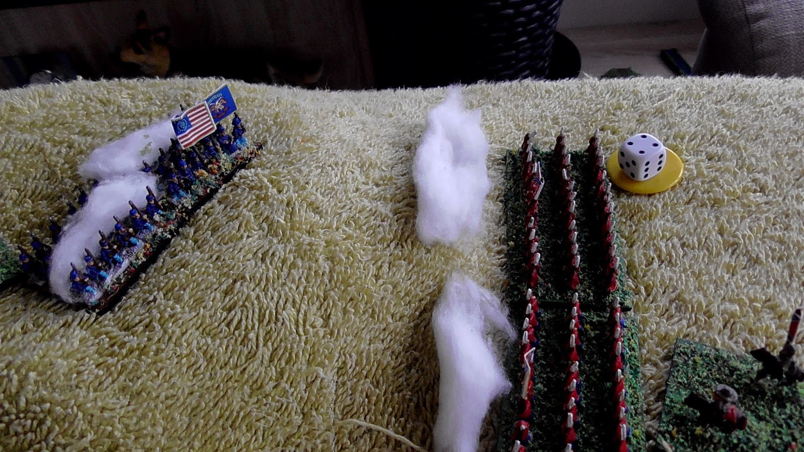
One member of each of the four current foot regiments for two of the countries of Culm, are now finished. They are as good as my limited painting skills and eyes can manage. The camera is brutal as ever, but they actually look fine to me on the table, from normal viewing distance.
I am going for the toy soldier look, which for this project means no washes or inks, not to everyone's taste, but I only have to please myself.
Each of these guys has 23 mates that now need painting up, that is going to take a few months, and will be interspersed with the 28 mm AWI and 10 mm Napoleonic troops. Lots to keep me busy.
I am also working on the back story, characters, finances etc. for the various countries involved.
A conversation with my buddy Kurtus, got me thinking too. If this war spreads to other countries in Culm, my initial idea was for just three being involved, then maybe 10 mm would be the way to go if other nations do become involved.
It would be prohibitive, both in cost and storage space, to do more in 28mm, but Pendraken do an army box for £31 which contains infantry, cavalry and artillery. Lots of them too, and as a pack of 30 infantry or 15 cavalry or two cannon with crew, horse and limbers, retail at £4.95 each, a very affordable and doable way to go if needed in the future.
Certainly something for me to ponder.
The next task is to order some MDF bases. 40 x 40 mm for infantry (4 figures), 50 x 50 mm for cavalry (2 figures) and 75 x 75 mm for artillery and crew. A number of 50 and 75 mm rounds will also be needed for command figures.
Model Soldiers, Table Top Battles, Campaigns and N Gauge Model Railways.
Showing posts with label Creating a campaign. Show all posts
Thursday, 2 March 2017
Tuesday, 28 February 2017
More thoughts on my Imagi-Nation continent of Culm.
Back on the 8th February this year, I posted an article to this blog entitled 'A Germ of an Idea. In which I mentioned using a map of Ireland as a continent, and picking a part of it for my Imagi-Nations campaign. I was going to keep all the original names of counties, towns, rivers etc. but have now decided to actually rename them all. I shall still be using Ireland, as I love the topography of the whole island.
I have selected an interesting part of Ireland (Culm), for the first three of my new nations. We have an ocean to the east, a series of mountain or hill ranges, running roughly north/south, rivers, and of course main road systems linking towns.
This is pretty much the same area as above, with the counties and their borders. I am looking at Wicklow on the east coast, it will be renamed 'Walivia.' on its south west border is Carlow, now to be named 'Cadesh,' which has a western border with Kilkenny 'Kiracia.'
Of course the surrounding countries of Darini (Dublin), Kaohaken (Kildare), Lothoir (Laois), Tasilan (Tipperary), Walemeth (Waterford) and Wiceameth (Wexford), could all be drawn into the conflict.
The final map is an attempt to combine the two previous, placing each country in the physical land. Not too easy to read, but flicking between the other two, easy enough to work out what is going on, and sets the towns etc, down on the natural features of the land.
There is still much to be done of course, the books by Don Featherstone and Tony Bath, are a mine of information, as are a few blogs I have found. All good inspiration, as was the arrival of my two boxes of Marlborough troops.
I will continue to post updates on Culm as and when there is something to share.
I have selected an interesting part of Ireland (Culm), for the first three of my new nations. We have an ocean to the east, a series of mountain or hill ranges, running roughly north/south, rivers, and of course main road systems linking towns.
This is pretty much the same area as above, with the counties and their borders. I am looking at Wicklow on the east coast, it will be renamed 'Walivia.' on its south west border is Carlow, now to be named 'Cadesh,' which has a western border with Kilkenny 'Kiracia.'
Of course the surrounding countries of Darini (Dublin), Kaohaken (Kildare), Lothoir (Laois), Tasilan (Tipperary), Walemeth (Waterford) and Wiceameth (Wexford), could all be drawn into the conflict.
The final map is an attempt to combine the two previous, placing each country in the physical land. Not too easy to read, but flicking between the other two, easy enough to work out what is going on, and sets the towns etc, down on the natural features of the land.
There is still much to be done of course, the books by Don Featherstone and Tony Bath, are a mine of information, as are a few blogs I have found. All good inspiration, as was the arrival of my two boxes of Marlborough troops.
I will continue to post updates on Culm as and when there is something to share.
Monday, 13 February 2017
Back to painting and more thoughts on campaigning.
After problems with my eyes, now hopefully sorted out. I picked up a brush for the first time in two months this lunchtime. I listened to the After Hours Paint & Chat with Matt, for company, and did a little more work on the 4th New York.
I restricted myself to just one hour, this allowed me to correct a couple of errors in the already painted figures, as well as assembling six more. I don't normally assemble until the torsos are painted, but for this half a dozen, I am experimenting, as having the figures already fully assembled, makes more sense.
The initial six are now almost complete, just a little highlighting here and there.
The next six, some with arms already part painted, from using my old method. A drummer, officer and standard bearer, as well as three more musketeers. I am going for twelve man battalions, all on single bases, this will allow for use in skirmish games, they can then be placed on movement trays for any other rule sets for larger battles. I may increase the unit to sixteen figures, but that is not settled yet.
Happy to be back painting again, and looking forward to doing one hour a day for the next week or two, after that, if no problems, then I can slowly extend that time, though I doubt I will paint in an evening in just artificial light. A perk of being retired, I can have most afternoons to follow my hobby.
I have also been giving a lot of thought to my campaign game using the Marlborough Starter sets currently on pre-order. I still at the moment, plan on using a map of Ireland, and also keep the names of all the counties, towns, rivers etc. But may transform Ireland into a continent, the counties becoming countries.
Culm, as the island/continent is currently known, suddenly offers a huge potential for a really in- depth campaign. Each country would have its own government/royal family/president/dictator etc. as well as armed forces, economy, diplomats and natural resources, to name but a few.
No longer a small island of two countries, which of course, would limit any future actions, one side may be rapidly defeated and so the whole thing would end rather abruptly. I have no intention of building armies for thirty odd countries, restricting myself initially to just perhaps three or four, gathered in one area of the continent. As time passes, alliances or incursions, may well drag other countries into alliances with the belligerents or perhaps neutrality, who knows?
I am at a very early stage of developing, what could be a huge project. It is even possible that some parts of the continent, are at a less advanced stage of development than others, could I use my Wars of the Roses, Arab, English Civil War and American War of Independence armies too?
Lots to think about.
I restricted myself to just one hour, this allowed me to correct a couple of errors in the already painted figures, as well as assembling six more. I don't normally assemble until the torsos are painted, but for this half a dozen, I am experimenting, as having the figures already fully assembled, makes more sense.
The initial six are now almost complete, just a little highlighting here and there.
The next six, some with arms already part painted, from using my old method. A drummer, officer and standard bearer, as well as three more musketeers. I am going for twelve man battalions, all on single bases, this will allow for use in skirmish games, they can then be placed on movement trays for any other rule sets for larger battles. I may increase the unit to sixteen figures, but that is not settled yet.
Happy to be back painting again, and looking forward to doing one hour a day for the next week or two, after that, if no problems, then I can slowly extend that time, though I doubt I will paint in an evening in just artificial light. A perk of being retired, I can have most afternoons to follow my hobby.
I have also been giving a lot of thought to my campaign game using the Marlborough Starter sets currently on pre-order. I still at the moment, plan on using a map of Ireland, and also keep the names of all the counties, towns, rivers etc. But may transform Ireland into a continent, the counties becoming countries.
Culm, as the island/continent is currently known, suddenly offers a huge potential for a really in- depth campaign. Each country would have its own government/royal family/president/dictator etc. as well as armed forces, economy, diplomats and natural resources, to name but a few.
No longer a small island of two countries, which of course, would limit any future actions, one side may be rapidly defeated and so the whole thing would end rather abruptly. I have no intention of building armies for thirty odd countries, restricting myself initially to just perhaps three or four, gathered in one area of the continent. As time passes, alliances or incursions, may well drag other countries into alliances with the belligerents or perhaps neutrality, who knows?
I am at a very early stage of developing, what could be a huge project. It is even possible that some parts of the continent, are at a less advanced stage of development than others, could I use my Wars of the Roses, Arab, English Civil War and American War of Independence armies too?
Lots to think about.
Wednesday, 8 February 2017
A germ of an idea.
Always thinking of ways to improve my wargaming experience, I picked up my copy of Don Featherstone's Creating a Campaign. A great source of ideas and of course it got the old brain cells ticking over.
I have seen and read, a number of Imagi-nation type blogs and find them fascinating, creating your own world or continent, filling it with imaginary nations and characters. Keeping a detailed diary, or should that be blog? in these more modern times of the internet.
Many seem to favour 18th or 19th Century, with armies in a distinctly European like setting. I can see the lure of this period, with fancy uniforms, allowing the gamer to really go to town creating uniforms and regimental flags for his troops. Maps are created, kings and governments rule the people, along with raising taxes to finance all those impressively dressed battalions.
My drawing skills are nil, so any map I created would look like something a five year old had drawn. Also, I really wanted to use troops that I already own, painted and based, ready for action. The answer I have come up with is to transpose the American Civil War to Ireland!
I already have the armies, and professionally created maps are freely and widely available on the net. I don't even have to think up imaginary place names, they are all there.
The scale of the map could be increased many fold if a continent is needed, the counties becoming countries, though the current scale will suit my purpose very well, I was going to rename the counties as states, or even call them shires, now where have I heard that before? But will probably keep them just as they are. I will of course need to come up with names for the two warring factions, Union and Confederate would not do at all in this fictional island nation. The counties breaking away, though it will certainly not be along the current borders of Ulster and the Republic, this isn't really Ireland after all. Using the first letter of the four main areas, Connacht Ulster Leinster Munster, gives me 'Culm' the name of my Imagi-nation.
I also found this map dated at 1850, which is pretty close to the 1860 period I would be emulating in my campaign. Very detailed with all the tiny villages also marked. A real treasure of a map. Rather difficult, if not impossible, to read here, but the saved copy on my hard drive, allows me to zoom in on particular areas with no problem.
So the nation of Culm is born. There is a lot more work to be done before it is playable, but an enjoyable task ahead. I will record that journey here, and it may even warrant its own blog later, we shall have to see.
I have seen and read, a number of Imagi-nation type blogs and find them fascinating, creating your own world or continent, filling it with imaginary nations and characters. Keeping a detailed diary, or should that be blog? in these more modern times of the internet.
Many seem to favour 18th or 19th Century, with armies in a distinctly European like setting. I can see the lure of this period, with fancy uniforms, allowing the gamer to really go to town creating uniforms and regimental flags for his troops. Maps are created, kings and governments rule the people, along with raising taxes to finance all those impressively dressed battalions.
My drawing skills are nil, so any map I created would look like something a five year old had drawn. Also, I really wanted to use troops that I already own, painted and based, ready for action. The answer I have come up with is to transpose the American Civil War to Ireland!
I already have the armies, and professionally created maps are freely and widely available on the net. I don't even have to think up imaginary place names, they are all there.
The topography is ideal for a wargame campaign.
The scale of the map could be increased many fold if a continent is needed, the counties becoming countries, though the current scale will suit my purpose very well, I was going to rename the counties as states, or even call them shires, now where have I heard that before? But will probably keep them just as they are. I will of course need to come up with names for the two warring factions, Union and Confederate would not do at all in this fictional island nation. The counties breaking away, though it will certainly not be along the current borders of Ulster and the Republic, this isn't really Ireland after all. Using the first letter of the four main areas, Connacht Ulster Leinster Munster, gives me 'Culm' the name of my Imagi-nation.
The counties and major towns, already named for me.
I also found this map dated at 1850, which is pretty close to the 1860 period I would be emulating in my campaign. Very detailed with all the tiny villages also marked. A real treasure of a map. Rather difficult, if not impossible, to read here, but the saved copy on my hard drive, allows me to zoom in on particular areas with no problem.
So the nation of Culm is born. There is a lot more work to be done before it is playable, but an enjoyable task ahead. I will record that journey here, and it may even warrant its own blog later, we shall have to see.
Saturday, 3 December 2016
OHW - The Campaign - Part Seven.
The next scenario in the book is titled 'Flank Attack (2).' The whole Union force has to start on the large hill in the North, a small hill opposite has two units of enemy troops, but the remaining four units are placed in the marked area in the top right hand corner. The idea being that the Union commander is expecting an attack from the South, but the Rebels have worked around to his flank with the greater part of their force.
Looking from the small hill to the larger one in the North.
The area in which four Confederate units will be placed on the flank.
Rolling the die for composition of forces produced the following:
The artillery and one unit of infantry positioned on the small hill.
All the Union units on the large hill.
The Confederate flanking force.
Top down view of the battlefield.
'After the Union debacle on the Bewick Road, the rebel army switched to the offensive, striking North. Brigadier General Dale Norbeck was ordered to hold Lookout Hill, in an attempt to slow down the Rebel advance.
General Norbeck glassed the small hill opposite, he could see a battery of artillery unlimbering. with them a regiment of infantry was also deploying into battle line. He grunted, that was not much of a force, something wasn't quite right! Intelligence had reported a brigade sized formation advancing on his force. From his position atop the hill, he had a clear view in every direction. The rolling hills and small wooded areas, were plain to see in every direction. If the enemy was trying to outflank him, he would be able to see them, with plenty of time to to adjust his defensive lines. What were the Rebels planning?'
He would soon find out...
Two events separated by millions of years would work against General Norbeck today. The first occurred when the very hill he was perched, on tore itself apart in a huge explosion. For the stunted hill was only the remains of a once mighty volcano. The land for hundreds of miles around was in constant movement, lava breaking the surface and forming chasms, only for a later shift of the tectonic plate to close them up and create new ones. The magma chamber below the volcano, boiled and pulsated with the movement around it, the pressure built up to incredible levels. The top of the volcano had been plugged tight by the shifting and twisting of millions of years.
With no means of escape, the pressurised lava exploded, vaporizing most of the mountain. The molten rock now free of the chamber, gushed down the remains of the volcano, some of it running into wide chasm to the East.
Over the intervening years, that winding chasm, had itself been slowly filled and eroded until today, it was no more than a shallow depression, running roughly North/South. It was however totally invisible to anyone looking across from Lookout Hill.
The second rather more recent event, was that Brigadier Frank Frey had been born in this very county, and he knew the countryside like the back of his hand. He was still smarting from his defeat at the Battle of The Two Brothers at the very hands of Dale Norbeck, though at this moment in time, Frank had no idea the two of them would once again be crossing swords. He had led most of his brigade North along the narrow, winding gully, knowing he would not be seen from the Lookout Hill, which he had been ordered to capture.
General Norbeck wasn't going to let the enemy cannon, on the small hill opposite, tear huge holes in his lines at their leisure. He ordered a regiment of cavalry to advance, it would give the gunners something to think about.
He was about to order his second unit of cavalry to assist them, when a startled shout went up from one of his aides, Enemy infantry on the flank sir! He didn't need his binoculars, the enemy were so close. Where in the hell had they sprung up from? Enemy troops, masses of them, stretched right along his flank to a wood, and those troops were already on the move.
The cavalry dismounted to face a regiment of Zouaves who were already in musket range.
The only regiment in range opened fire and scored a hit on a Zouave regiment.
The Union cavalry dispatched to trouble the gun crews also dismounted and prepared for action.
General Norbeck was no man's fool. The only way to defend this hill was to move his men off it, and form a battle line facing the newly arrived foe.
The Union troops begin to move down the slope of the hill.
More enemy troops appeared coming out of the wood.
The right flank Zouaves fired a devastating volley into the dismounted troopers on the hill.
The second unit of Zouves also poured shots into their target, the infantry on the hill.
The Rebel artillery fired a salvo at the closest Union infantry, as it descended the hill.
A single hit being the result.
The Union troops struggled forward, they could now see more of the enemy in the wood.
Gunners dropped as the troopers unleashed a volley.
The troopers on the hill, also hit their mark.
So too, the infantry. Both units of Confederate Zouaves suffering casualties.
The Reb infantry on the hill moved down the slope to join the fight, they would hit the flank of the enemy.
The last unit emerged from the wood.
The artillery switch target to their aggressors and score a single hit.
Devastating Confederate fire ripped through the Yankee ranks, dropping men by the score.
Both the infantry and troopers on the hill were close to destruction.
Again the gunners came under sustained carbine fire.
Casualties mounted alarmingly.
The Union troops from the hill, were now in musket range of the enemy units who had emerged from the wood. The Rebels suffering heavy losses.
A potentially final volley from the hill, score hits on the Zouaves, but not enough.
The artillery and troopers continue their own private duel.
Hit in the flank and front, this Union regiment escaped lightly.
However, the Union Zouaves did not fare so well, their ranks thinning fast.
On the hill, it was disaster for Dale, both the infantry and cavalry troopers were swept away by volleys from the enemy Zouaves.
The battle in full swing.
More hits on the gun crews.
The Confederate infantry now began to suffer substantial losses.
General Norbeck moved his only reserve, to face the advancing Zouaves.
Hit once again from two sides, this Union infantry took casualties, but poor shooting kept the hits down.
The Union Zouaves take more fire and are close to destruction.
The two gun lines remain toe to toe, the casualties are numerous, both sides are starting to waver.
A volley from the Zouaves destroys a Rebel regiment.
The Zouaves facing the hill take some hits from the last Union regiment defending the summit.
The artillery/cavalry duel continues, with little damage done by either side.
Being hit from two side finally took its toll, and the Union regiment was destroyed.
In a moment the Union line disintegrated, the Zouaves broke.
A crushing volley from the two Zouaves units, obliterated the regiment on the hill.
The carnage can be seen on the battlefield.
General Norbeck called back his cavalry and left Lookout Hill to the enemy.
General Frey's Brigade had taken heavy casualties, but had achieved their mission, they had taken Lookout Hill. He was even more satisfied a couple of days later, when he found out the defending general was none other than General Norbeck. Honours were now even.
That puts the campaign points at 4 - 3 in favour of the Union, with the Confederates now pushing the Union army back.
Looking from the small hill to the larger one in the North.
The area in which four Confederate units will be placed on the flank.
Rolling the die for composition of forces produced the following:
Union
1 x unit of Zouaves
3 x units of Infantry
2 x units of Cavalry
Confederate
1 x unit of Artillery
2 x units of Zouaves
3 x units of Infantry
The artillery and one unit of infantry positioned on the small hill.
All the Union units on the large hill.
The Confederate flanking force.
Top down view of the battlefield.
'After the Union debacle on the Bewick Road, the rebel army switched to the offensive, striking North. Brigadier General Dale Norbeck was ordered to hold Lookout Hill, in an attempt to slow down the Rebel advance.
General Norbeck glassed the small hill opposite, he could see a battery of artillery unlimbering. with them a regiment of infantry was also deploying into battle line. He grunted, that was not much of a force, something wasn't quite right! Intelligence had reported a brigade sized formation advancing on his force. From his position atop the hill, he had a clear view in every direction. The rolling hills and small wooded areas, were plain to see in every direction. If the enemy was trying to outflank him, he would be able to see them, with plenty of time to to adjust his defensive lines. What were the Rebels planning?'
He would soon find out...
Two events separated by millions of years would work against General Norbeck today. The first occurred when the very hill he was perched, on tore itself apart in a huge explosion. For the stunted hill was only the remains of a once mighty volcano. The land for hundreds of miles around was in constant movement, lava breaking the surface and forming chasms, only for a later shift of the tectonic plate to close them up and create new ones. The magma chamber below the volcano, boiled and pulsated with the movement around it, the pressure built up to incredible levels. The top of the volcano had been plugged tight by the shifting and twisting of millions of years.
With no means of escape, the pressurised lava exploded, vaporizing most of the mountain. The molten rock now free of the chamber, gushed down the remains of the volcano, some of it running into wide chasm to the East.
Over the intervening years, that winding chasm, had itself been slowly filled and eroded until today, it was no more than a shallow depression, running roughly North/South. It was however totally invisible to anyone looking across from Lookout Hill.
The second rather more recent event, was that Brigadier Frank Frey had been born in this very county, and he knew the countryside like the back of his hand. He was still smarting from his defeat at the Battle of The Two Brothers at the very hands of Dale Norbeck, though at this moment in time, Frank had no idea the two of them would once again be crossing swords. He had led most of his brigade North along the narrow, winding gully, knowing he would not be seen from the Lookout Hill, which he had been ordered to capture.
General Norbeck wasn't going to let the enemy cannon, on the small hill opposite, tear huge holes in his lines at their leisure. He ordered a regiment of cavalry to advance, it would give the gunners something to think about.
He was about to order his second unit of cavalry to assist them, when a startled shout went up from one of his aides, Enemy infantry on the flank sir! He didn't need his binoculars, the enemy were so close. Where in the hell had they sprung up from? Enemy troops, masses of them, stretched right along his flank to a wood, and those troops were already on the move.
The cavalry dismounted to face a regiment of Zouaves who were already in musket range.
The only regiment in range opened fire and scored a hit on a Zouave regiment.
The Union cavalry dispatched to trouble the gun crews also dismounted and prepared for action.
General Norbeck was no man's fool. The only way to defend this hill was to move his men off it, and form a battle line facing the newly arrived foe.
The Union troops begin to move down the slope of the hill.
More enemy troops appeared coming out of the wood.
The right flank Zouaves fired a devastating volley into the dismounted troopers on the hill.
The second unit of Zouves also poured shots into their target, the infantry on the hill.
The Rebel artillery fired a salvo at the closest Union infantry, as it descended the hill.
A single hit being the result.
The Union troops struggled forward, they could now see more of the enemy in the wood.
Gunners dropped as the troopers unleashed a volley.
The troopers on the hill, also hit their mark.
So too, the infantry. Both units of Confederate Zouaves suffering casualties.
The Reb infantry on the hill moved down the slope to join the fight, they would hit the flank of the enemy.
The last unit emerged from the wood.
The artillery switch target to their aggressors and score a single hit.
Devastating Confederate fire ripped through the Yankee ranks, dropping men by the score.
Both the infantry and troopers on the hill were close to destruction.
Again the gunners came under sustained carbine fire.
Casualties mounted alarmingly.
The Union troops from the hill, were now in musket range of the enemy units who had emerged from the wood. The Rebels suffering heavy losses.
A potentially final volley from the hill, score hits on the Zouaves, but not enough.
The artillery and troopers continue their own private duel.
Hit in the flank and front, this Union regiment escaped lightly.
However, the Union Zouaves did not fare so well, their ranks thinning fast.
On the hill, it was disaster for Dale, both the infantry and cavalry troopers were swept away by volleys from the enemy Zouaves.
The battle in full swing.
More hits on the gun crews.
The Confederate infantry now began to suffer substantial losses.
General Norbeck moved his only reserve, to face the advancing Zouaves.
Hit once again from two sides, this Union infantry took casualties, but poor shooting kept the hits down.
The Union Zouaves take more fire and are close to destruction.
The two gun lines remain toe to toe, the casualties are numerous, both sides are starting to waver.
A volley from the Zouaves destroys a Rebel regiment.
The Zouaves facing the hill take some hits from the last Union regiment defending the summit.
The artillery/cavalry duel continues, with little damage done by either side.
Being hit from two side finally took its toll, and the Union regiment was destroyed.
In a moment the Union line disintegrated, the Zouaves broke.
A crushing volley from the two Zouaves units, obliterated the regiment on the hill.
The carnage can be seen on the battlefield.
General Norbeck called back his cavalry and left Lookout Hill to the enemy.
General Frey's Brigade had taken heavy casualties, but had achieved their mission, they had taken Lookout Hill. He was even more satisfied a couple of days later, when he found out the defending general was none other than General Norbeck. Honours were now even.
That puts the campaign points at 4 - 3 in favour of the Union, with the Confederates now pushing the Union army back.
Subscribe to:
Posts (Atom)